
By Wes O’Donnell
Managing Editor, In Space News, InCyberDefense and In Military
This week in 1972, NASA launched the Earth Resources Technology Satellite from Vandenberg Air Force Base in California. It was later renamed Landsat 1.
Get started on your Space Studies Degree at American Military University. |
Containing a camera system built by the Radio Corporation of America (RCA), Landsat 1 was comprised of two primary instruments: the Return Beam Vidicon (RBV) and the Multispectral Scanner (MSS). The RBV was supposed to be the prime instrument, but the MSS data was found to be superior.
Landsat 1 was the world’s first Earth-observing satellite launched to monitor the planets’ landmasses.
To analyze the data, NASA employed over 300 private research investigators.
Data created from nearly 150,000 Landsat 1 images are available to download from EarthExplorer, GloVis and the LandsatLook Viewer.
Landsat Facts
Landsat 1 was a modified Nimbus meteorological satellite. Here are some additional facts:
- Weight: approximately 953 kg (2,100 lbs)
- Overall height: 3 m (10 ft)
- Diameter: 1.5 m (5 ft)
- Solar array paddles extend out to a total of 4 m (13 ft)
- 3-axis stabilized using 4 wheels to +/-0.7° attitude control
- Twin solar array paddles (single-axis articulation)
- S-Band and Very High Frequency (VHF) communications
- Hydrazine propulsion system with 3 thrusters
Landsat Program Continues to Supply Space Images
The Landsat program is still going strong. Landsat 8 launched in 2013 and is still returning images to scientists. Landsat 9 is scheduled to launch in 2020 or 2021.
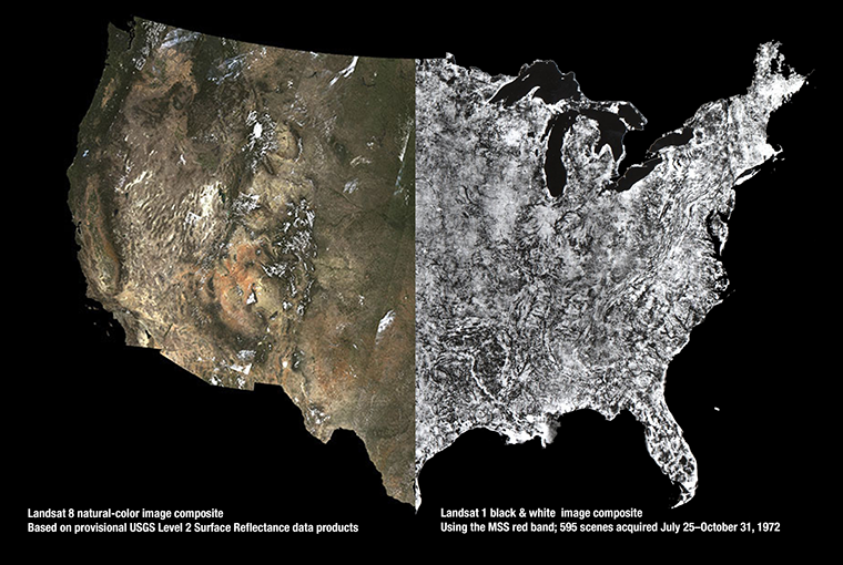
Image courtesy of NASA, Landsat 1 and Landsat 8 comparison image
Comments are closed.